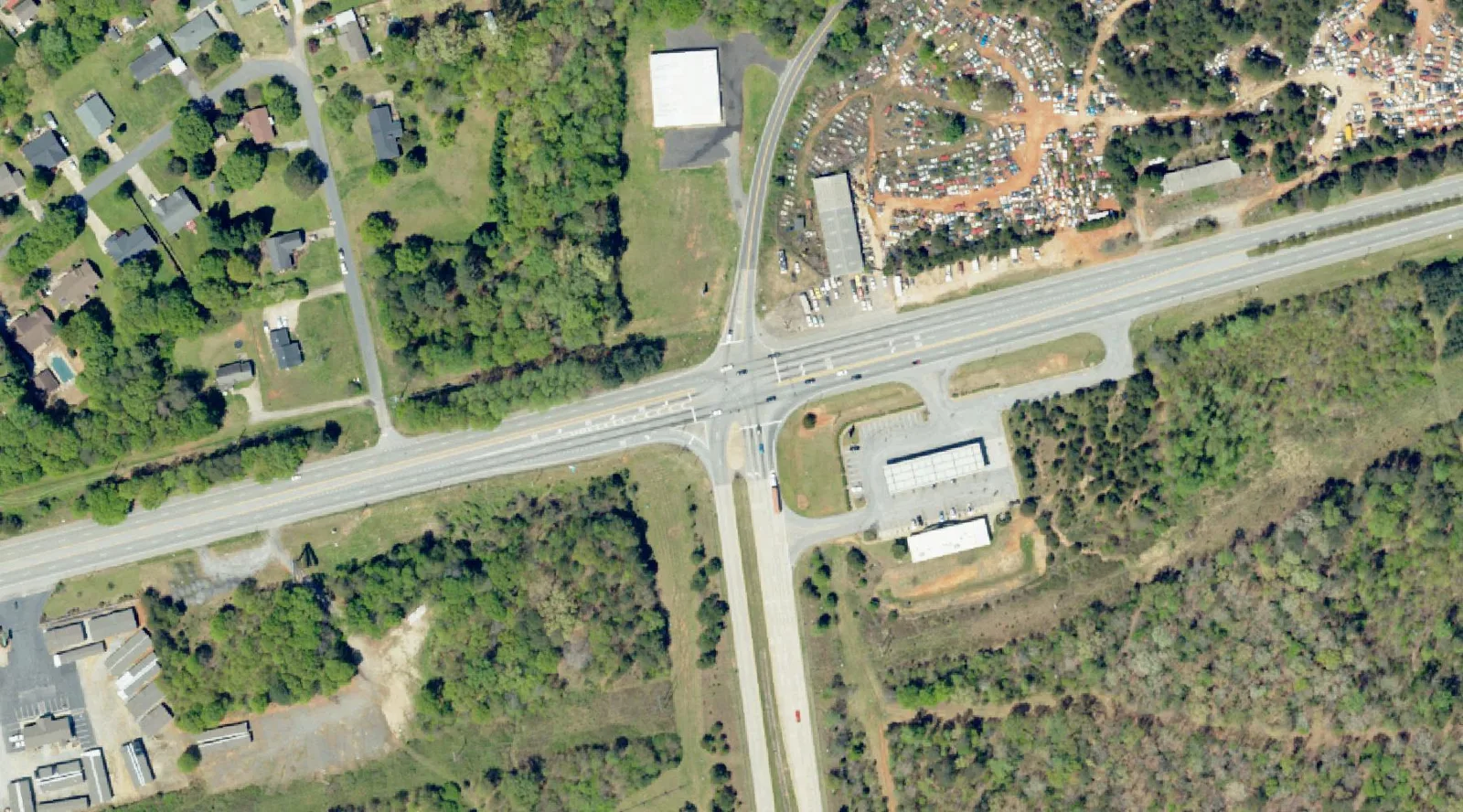
US 29 had 14 deadly or serious crashes in Greer's new safety study, the most of any road. See the 10 priority spots and the fixes the study suggests.
US 29 is the most dangerous road in Greer, according to a new city safety study. It had 14 crashes that killed or seriously injured someone, more than any other road the study ranked.
The City of Greer wants to hear from drivers, walkers and cyclists before the plan is finished. It held a Transportation Safety Open House from 5 to 7 p.m. Thursday, Oct. 22, on the second floor of City Hall, 301 E. Poinsett St.
The city announced the open house in an Oct. 8 release. Consultants at Bolton & Menk are writing the Transportation Safety Action Plan, which aims to eliminate deadly and serious-injury crashes. A federal Safe Streets and Roads for All grant pays for it, the city said.
Updated Oct. 23: The open house took place Oct. 22. The city has not yet posted a recap, a comment deadline or a date for the draft plan. We will add them here when it does.
What the study found
The consultants posted their findings on an interactive project website. It focuses on the most severe crashes, those that cause a death or a serious injury, using crash data from 2020 to 2024.
- Angle crashes made up 44% of the deadly and serious crashes. These are T-bone and intersection crashes.
- Lane departure crashes were 28%. That covers running off the road, head-on crashes and sideswipes.
- Rear-end crashes were 13%, even though rear-end is the most common type of crash overall.
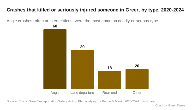
The study’s chart counts 60 angle crashes, 39 lane departure crashes, 18 rear-end crashes and 20 others in that group.
People walking and biking stand out. They were involved in 1% of all crashes but 19% of the crashes that killed or seriously injured someone, the study found.
The 10 priority locations
The study names seven intersections and three road segments for safety work. It counts the deadly and serious-injury crashes at each one.
| Location | Deadly or serious crashes | What the study suggests |
|---|---|---|
| US 29 (road segment) | 14 | Signal and pedestrian upgrades, access and speed management, filling sidewalk gaps |
| Brushy Creek Road (segment) | 6 | Wider culvert for wider lanes and shoulders, rumble strips, guardrail |
| SC 101 at Brockman McClimon Road | 2 | Signal timing review, left-turn lanes on side streets, signal-ahead flashers |
| US 29 at Gary Armstrong Road | 1 | Signal timing review, remove the eastbound slip ramp, signal-ahead flashers |
| SC 14 at Westmoreland Road | 1 | Signal timing review, high-visibility crosswalks, extra signal heads on curves |
| SC 101 at Oneal Church Road | 1 | Roundabout, or a signal and turn lanes |
| Milford Church Road at Ridge Crossing | 1 | Roundabout, or a signal and turn lanes |
| SC 101 at North Jones Road | 0 | Signal timing review, yield line on the southbound right turn, offset or protected left turns |
| Westmoreland Road at Nature Trail Drive | 0 | Better signs and markings, clearing the curve for sight distance, realigning the side street |
| Brockman McClimon Road (segment) | 0 | Straightening the curve, guardrail, paved shoulders, center-line rumble strips |
Many roads in Greer belong to the South Carolina Department of Transportation, not the city, the study notes. That gives the city less say over fixes on them. The project team said it therefore prioritized intersections and segments the city fully or partly owns for future improvements.
Speed is the common thread
Lower speeds appear in the study’s advice for every crash type. “Speed plays a big role in making crashes dangerous,” the project website says.
Other fixes it describes include protected left-turn signals, roundabouts, medians, rumble strips, better lighting and curve warning signs. For people on foot, it suggests high-visibility crossings, more sidewalks and shorter crossing distances.
What it means for you
- Missed the open house? The project website has a crash map and a survey link for feedback.
- Know a dangerous spot the study missed? The project team said it wants to know “if we missed anything important.”
Current lane closures and detours are on our Greer road construction and closures page. For buses, trails and commuting, see getting around Greer.
Have your say