Burgiss Hills, north of Wade Hampton Boulevard on Greer's Greenville County side, is in ZIP 29651 and zoned for Greer Middle and Greer High.
Last checked Oct. 16, 2026. Sources: OpenStreetMap place names, the City of Greer’s GIS map service (city limits, address points and major thoroughfares), the South Carolina Department of Archives and History, Greenville County Schools’ Find Your School, the state’s 2025 school report cards and Zillow Research.
Burgiss Hills sits just north of Wade Hampton Boulevard (US 29), where Locust Hill Road and O’Neal Road meet North Buncombe Road. It is a small, mostly single-family corner of the city’s Greenville County side, close to the shopping on US 29 and to a peach packing shed from Greer’s farming days.
What this means for you
- Zoned high school: Greer High, with Greer Middle and, for most addresses, Chandler Creek Elementary. Check an address in Find Your School.
- Home value: $336,521 in ZIP 29651 in September 2026, according to the Zillow Home Value Index.
- Nearest interstate exit: I-85 Exit 56, SC 14, about 6.1 miles by road.
Part of our Greer neighborhoods guide.
Where it is
OpenStreetMap places Burgiss Hills, and next to it Mount Vernon Estates, inside the city just north of Wade Hampton Boulevard and west of North Buncombe Road. The city does not draw neighborhood boundaries, so on this page the area means the residential addresses inside Greer’s city limits north of US 29 and west of the Chandler Road neighborhoods, up to the Lake Cunningham area.
The city’s address file has about 340 residential addresses there, all in Greenville County and nearly all in ZIP code 29651. Most are single-family homes on streets such as Mount Vernon Road, Mount Vernon Circle, Blue Ridge Drive, Laurel Road, Chestnut Avenue, Peachtree Drive, Hillside Drive and Brookwood Drive. The main roads are Locust Hill Road (SC 290), O’Neal Road (SC 101) and North Buncombe Road, all on the city’s major thoroughfare map.
The peach shed
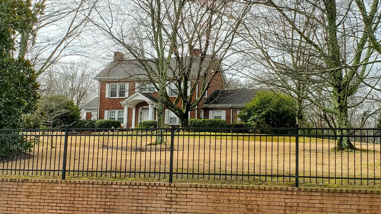
The Earle R. Taylor House and Peach Packing Shed, 1001 Locust Hill Road, stands on the area’s edge, just outside the city limits. It was listed on the National Register of Historic Places on June 27, 2012. The state’s National Register listing says the Taylor family was among the first in the area to grow peaches: Earle Taylor started his operation in 1917 and was shipping peaches north by rail by 1920, and at its peak the 900-acre farm had 30,000 peach and apple trees. The two-story brick Colonial Revival house, designed by local architect Thomas Keating, dates from 1939. The open, wood-framed packing shed, from about 1925, sits across a busy highway from the house, and the state calls it a rare intact example of an upstate peach packing shed. The state notes that most National Register properties are privately owned and asks visitors to respect the owners’ privacy.
Schools
We checked 16 residential addresses across the area in Greenville County Schools’ Find Your School tool on Oct. 16, 2026; the tool matched 15 of them to an exact address. Ratings are the overall ratings on the 2025 state report cards (the 2024-25 school year), on a scale of Excellent, Good, Average, Below Average and Unsatisfactory.
| Level | School | Addresses checked | 2025 rating |
|---|---|---|---|
| High | Greer High, 3000 E. Gap Creek Road | 15 of 15 | Good |
| Middle | Greer Middle, 3032 E. Gap Creek Road | 15 of 15 | Good |
| Elementary | Chandler Creek Elementary, 301 Chandler Road | 14 of 15 | Average |
| Elementary | Crestview Elementary, 509 American Legion Road | 1 of 15 | Good |
The elementary line can split within a small area, so check the exact address. More in our schools guide.
Home values
The typical home value in ZIP 29651 was $336,521 in September 2026, up 1.57% from $331,307 in September 2025, according to the Zillow Home Value Index. The index is a modeled typical value for the middle third of homes, not a sale price, and ZIP 29651 covers most of northern and eastern Greer. The citywide figure was $349,020, up 1.15% on the year. More in our home prices guide.
Parks and trails
Neither the city’s parks list nor OpenStreetMap shows a park inside the area. The nearest city facility is Tryon Park and Recreation Center, 226 Oakland Ave., south of Wade Hampton Boulevard, with tennis and 10 pickleball courts, according to the city’s parks page. More in our parks guide.
Getting around
- Interstate: I-85 Exit 56, SC 14, about 6.1 miles by road from the middle of the area. The exit number is from OpenStreetMap.
- Downtown Greer: about 2.4 miles by road to City Hall, 301 E. Poinsett St.
- Airport: about 7.7 miles by road to the terminal at Greenville-Spartanburg International Airport. Both are distances measured on the OpenStreetMap road network with the OSRM routing engine, not drive times.
More in our getting around guide.
Groceries and everyday stores
From OpenStreetMap: Ingles, 1524 Locust Hill Road, inside the area, and along Wade Hampton Boulevard just south of it, ALDI, 1050 W. Wade Hampton Blvd., and Walgreens, 1232 W. Wade Hampton Blvd.
How we drew this area
The Burgiss Hills and Mount Vernon Estates names come from OpenStreetMap’s place markers. The edges follow Wade Hampton Boulevard, the Chandler Road side of the north end of town, the Lake Cunningham area and the city limits. School zones come from 15 residential addresses matched in Find Your School. Store locations are © OpenStreetMap contributors.
Frequently asked questions
What schools is Burgiss Hills in Greer zoned for?
Of 15 addresses we matched in the district’s Find Your School tool, 14 were zoned for Chandler Creek Elementary (rated Average on the 2025 state report card) and one for Crestview Elementary (Good). All 15 were zoned for Greer Middle (Good) and Greer High (Good).
What is the old peach shed on Locust Hill Road in Greer?
The Earle R. Taylor House and Peach Packing Shed at 1001 Locust Hill Road, listed on the National Register of Historic Places on June 27, 2012. The state says the shed dates from about 1925 and the Colonial Revival house from 1939.
Is Burgiss Hills a good place to live?
Here are the facts. Burgiss Hills is a single-family area on Greer’s Greenville County side about 2.4 miles by road from City Hall, zoned for Greer High, rated Good for 2025. The typical home value in ZIP 29651 was $336,521 in September 2026, according to Zillow.
Have your say