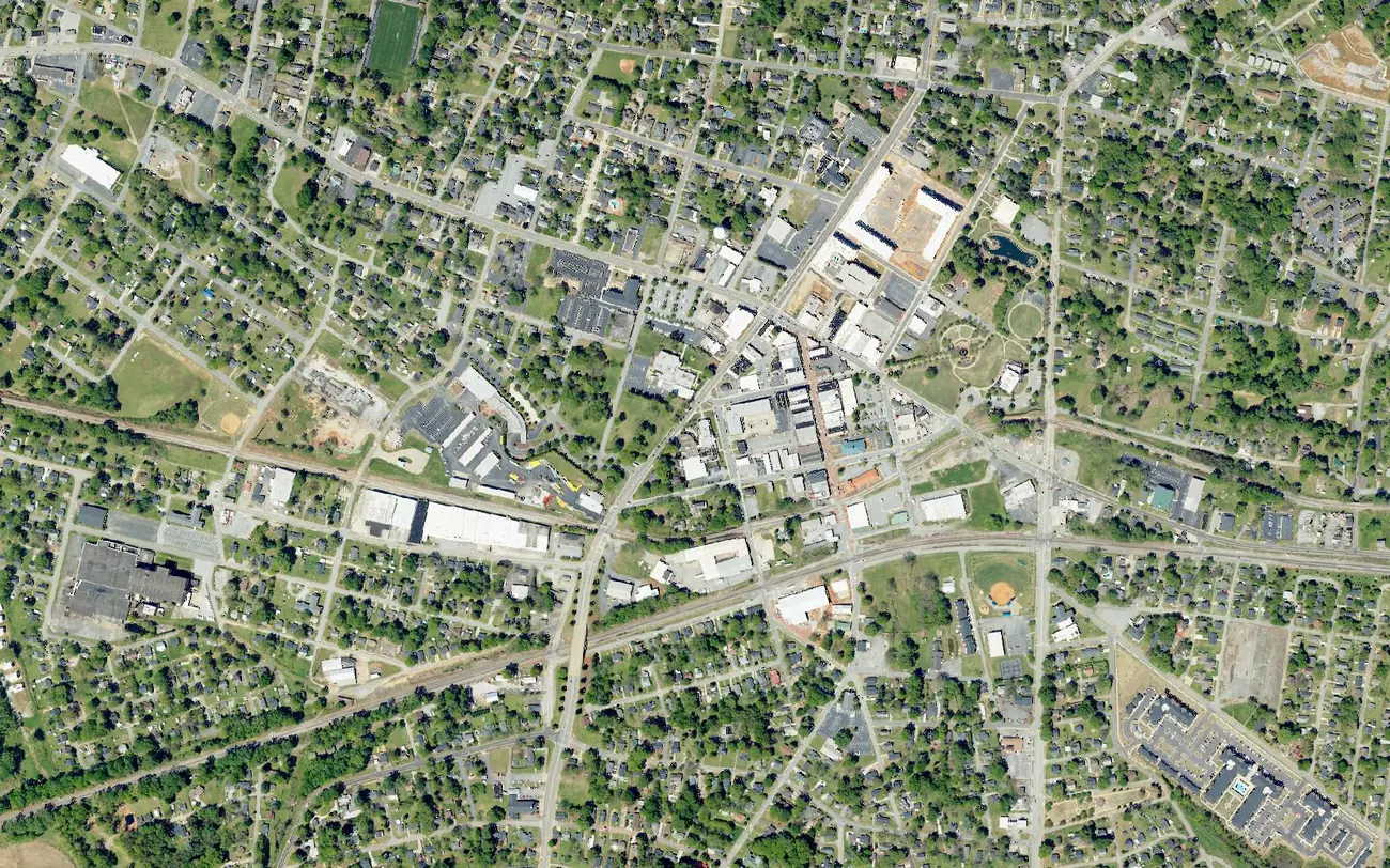
Greer's 11 main residential areas, from downtown to Lake Robinson and Pelham: ZIP codes, zoned high schools and Zillow home values for each.
Last checked Oct. 16, 2026. Sources: the City of Greer’s GIS map service (city limits, county line, future land use, address points and thoroughfares) and 2025 comprehensive plan update (PDF), OpenStreetMap, Greenville County Schools’ Find Your School, Spartanburg District 5’s attendance lines map, the state’s 2025 school report cards, Zillow Research and the Census Bureau.
Greer is a city of about 41,500 people, according to the Census Bureau’s 2020-2024 American Community Survey, spread over about 37 square miles on the city’s own boundary map. It is shaped less like a circle than a long, uneven arm: from the south end of Lake Robinson in the northwest, through downtown, to subdivisions south of I-85. Pieces of unincorporated land sit inside and between its parts, so a Greer mailing address does not mean a home is in the city.
Four things shape where people live here:
- Two counties. Greer straddles the Greenville-Spartanburg county line, which runs down Line Street downtown. About 70% of the city’s residential addresses are in Greenville County and 30% in Spartanburg County, which decides who bills your property taxes.
- The main roads. I-85 crosses the south end of the city, with exits 56 (SC 14), 58 (Brockman McClimon Road) and 60 (SC 101). Wade Hampton Boulevard (US 29) runs east-west north of downtown; Main Street (SC 14) and Poinsett Street (SC 290) cross downtown; SC 101 runs north to the lakes and south past the BMW plant.
- Two main ZIP codes. Most homes use 29651 (the north, east and downtown) or 29650 (the west and southwest). The Lake Robinson area uses 29687 and part of Abner Creek uses 29334.
- School zones do not follow city or county lines. Greenville County Schools serves most of the city, including most homes on the Spartanburg County side. Spartanburg District 5 serves the Abner Creek area and parts of the east and southeast edges.
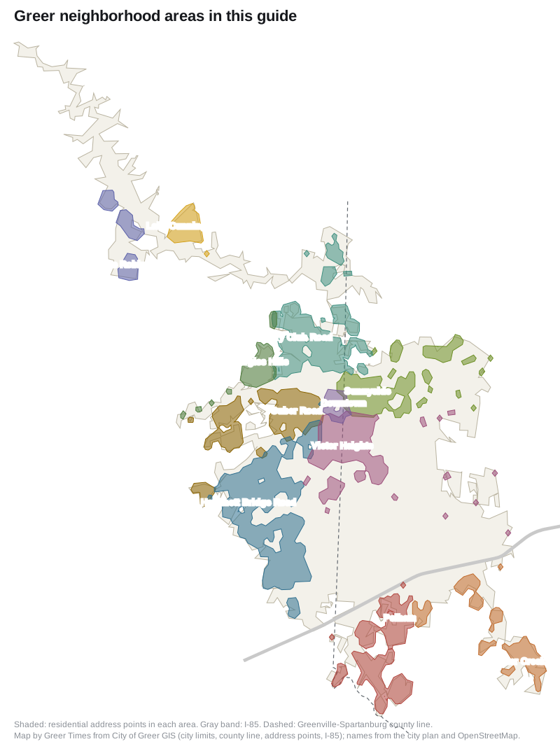
Map by Greer Times from the City of Greer’s GIS layers (city limits, county line, address points and I-85). Area names come from the city’s plan and OpenStreetMap, © OpenStreetMap contributors.
The areas at a glance
| Area | ZIP code | Zoned high school (most homes) | Typical home value in that ZIP, September 2026 | Guide |
|---|---|---|---|---|
| Downtown | 29651, 29650 | Greer High | $336,521 (29651) | Downtown |
| Victor Heights | 29651 | Greer High | $336,521 | Victor Heights |
| Sunnyside | 29651, 29365 | Greer High; Byrnes High on the east edge | $336,521 (29651) | Sunnyside |
| Burgiss Hills | 29651 | Greer High | $336,521 | Burgiss Hills |
| Country Club Road | 29651 | Greer High | $336,521 | Country Club Road |
| Lake Cunningham | 29651 | Greer High | $336,521 | Lake Cunningham |
| Lake Robinson | 29687 | Blue Ridge High | $308,506 | Lake Robinson |
| Suber Road | 29650 | Greer High | $369,431 | Suber Road |
| Hammett Bridge Road | 29650 | Riverside High | $369,431 | Hammett Bridge Road |
| Pelham | 29651 | Riverside High; Byrnes High on the east edge | $336,521 | Pelham |
| Abner Creek and Highway 101 South | 29651, 29334 | Byrnes High | $336,521 (29651) | Abner Creek |
Home values are the Zillow Home Value Index for the ZIP code, a modeled typical value for the middle third of homes, not a sale price. A ZIP code covers much more than one area, which is why several areas share a figure. The citywide value was $349,020 in September 2026. School zones come from addresses we checked in each district’s own tool or map on Oct. 16, 2026; check any single address before you buy or rent. Ratings for every school are in our schools guide, and prices over time are in our home prices guide.
Downtown
The city’s Downtown character area, about 167 acres around Trade Street, City Hall and Greer City Park, with the National Register-listed Greer Downtown Historic District at its core. Most homes are apartments. Read the Downtown guide.
Victor Heights
East and south of downtown, mostly on the Spartanburg County side of Line Street, around Victor Avenue, Victor Heights Park and Stevens Field, with newer homes on streets such as Village Mill Drive and Twill Road. Read the Victor Heights guide.
Sunnyside
Northeast of downtown, between Poinsett Street and Wade Hampton Boulevard, the neighborhood the city’s planned Wards Creek Trail will link to downtown. Homes on its far east edge are in District 5. Read the Sunnyside guide.
Burgiss Hills
A small single-family area just north of Wade Hampton Boulevard on Locust Hill and O’Neal roads, beside a National Register-listed peach packing shed. Read the Burgiss Hills guide.
Country Club Road
North of Wade Hampton Boulevard along Chandler Road and North Main Street up to Greer High, Greer Middle, Country Club Road Park and Greer Golf on the South Tyger River. Read the Country Club Road guide.
Lake Cunningham
Newer subdivisions along SC 101 near Lake Cunningham, one of Greer CPW’s two drinking-water reservoirs, where the city plans a new fire station. Read the Lake Cunningham guide.
Lake Robinson
The city’s farthest corner, at the south end of the 800-acre Lake Robinson, with a Taylors ZIP code and Blue Ridge schools. Read the Lake Robinson guide.
Suber Road
West of downtown on the Greenville County side, between Wade Hampton Boulevard and Brushy Creek Road along North and South Suber Road, with the Suber Road soccer fields and Kids Planet at Century Park. Read the Suber Road guide.
Hammett Bridge Road
The city’s largest residential area by address count, in the southwest between Brushy Creek Road and I-85, home to Riverside High, Riverside Middle, Woodland Elementary and East Riverside Park. Read the Hammett Bridge Road guide.
Pelham
South of I-85 along South Highway 14, on the Spartanburg County side but mostly zoned for Greenville County Schools. Read the Pelham guide.
Abner Creek and Highway 101 South
South of I-85 near the BMW plant, the one area where every home we checked is in Spartanburg District 5. Read the Abner Creek guide.
Other parts of the city
The older streets north of Poinsett Street and west of Main Street, around Oakland Avenue, Tryon Park and City Stadium, are not a separate guide. About 850 residential addresses there are in ZIP code 29650. The 16 we checked were all zoned for Greer High; 14 were zoned for Greer Middle and Chandler Creek Elementary, and two for Riverside Middle and Crestview Elementary.
To compare Greer with its neighbors, see Greer vs Lyman vs Greenville vs Mauldin.
How we built this
The city does not publish a list of neighborhoods, so we built the areas from sources we could put on a map. The Downtown area is the city’s own Downtown character area on its future land use map. The other names come from the city’s 2025 comprehensive plan update (Sunnyside, the Lake Cunningham area, Pelham-Batesville, Highway 101 south of I-85), OpenStreetMap’s place markers (Victor Heights, Sunnyside, Burgiss Hills, Pelham), the lakes and the main roads. The edges follow I-85, Wade Hampton Boulevard, Poinsett Street, Main Street, Brushy Creek Road, the county line and the city limits. We assigned every residential address point in the city’s file to one area, then checked schools in Greenville County Schools’ Find Your School tool and against Spartanburg District 5’s map. We left out place names we could not tie to a source or that name a single subdivision.
Frequently asked questions
What are the neighborhoods in Greer, South Carolina?
This guide covers 11 areas: Downtown, Victor Heights, Sunnyside, Burgiss Hills, Country Club Road, Lake Cunningham, Lake Robinson, Suber Road, Hammett Bridge Road, Pelham, and Abner Creek and Highway 101 South. The city itself does not draw neighborhood boundaries.
What ZIP codes are in Greer?
Most Greer homes use 29651 or 29650. Homes in the Lake Robinson area use 29687, and some in the Abner Creek area use 29334, even though they are inside the city limits.
What school district is Greer in?
Most of Greer, including most homes on the Spartanburg County side, is zoned for Greenville County Schools. The Abner Creek and Highway 101 South area and parts of the east and southeast edges are in Spartanburg District 5.
Which Greer neighborhoods are zoned for Riverside High?
Most homes in the Hammett Bridge Road and Pelham areas, according to the addresses we checked in Greenville County Schools’ Find Your School tool. Most other areas are zoned for Greer High, Lake Robinson for Blue Ridge High and Abner Creek for Byrnes High.
Is Greer in Greenville County or Spartanburg County?
Both. About 70% of the residential addresses in the city’s file are in Greenville County and about 30% in Spartanburg County. Line Street downtown is the county line.
Have your say