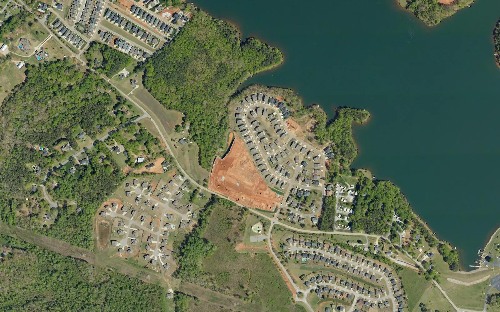
Greer's Lake Robinson area, at the south end of the city's reservoir, uses ZIP 29687 and is zoned for Mountain View Elementary and Blue Ridge Middle and High.
Last checked Oct. 16, 2026. Sources: the City of Greer’s GIS map service (city limits and address points), Greer CPW’s Lakes and Recreation page, the city’s 2025 comprehensive plan update (PDF), Greenville County Schools’ Find Your School, the state’s 2025 school report cards, Zillow Research and OpenStreetMap.
Greer’s city limits reach northwest of downtown to take in the south end of Lake Robinson, one of the two reservoirs Greer CPW runs for the city’s drinking water. The homes here are about 7.5 miles by road from City Hall, and every one uses the 29687 ZIP code.
What this means for you
- Zoned high school: Blue Ridge High, with Mountain View Elementary and Blue Ridge Middle. Check an address in Find Your School.
- Home value: $308,506 in ZIP 29687 in September 2026, according to the Zillow Home Value Index.
- Nearest interstate exit: I-85 Exit 56, SC 14, about 10.7 miles by road.
Part of our Greer neighborhoods guide.
Where it is
The city does not draw neighborhood boundaries. On this page the Lake Robinson area means the residential addresses inside Greer’s city limits at the lake’s south end, west of the Lake Cunningham area. The city’s address file has about 715 residential addresses there, all in Greenville County and all in ZIP code 29687, which Zillow lists under Taylors.
Most are single-family homes, on streets such as Double Crest Drive, Hidden Springs Lane, Bur Oak Drive, Nina Meadows Drive, Coolwater Drive, Hollander Drive and Stillwaters Bay Drive, with some townhomes. Batten Road runs through it. About a quarter of the residential address points in the city’s file are listed as land, not homes.
Schools
We checked 16 residential addresses across the area in Greenville County Schools’ Find Your School tool on Oct. 16, 2026; the 15 it matched to an exact address were all zoned for the same three schools, and the 16th matched to its street in the same zone. Ratings are the overall ratings on the 2025 state report cards (the 2024-25 school year), on a scale of Excellent, Good, Average, Below Average and Unsatisfactory.
| Level | School | Share of addresses checked | 2025 rating |
|---|---|---|---|
| High | Blue Ridge High, 2151 Fews Chapel Road | 100% | Excellent |
| Middle | Blue Ridge Middle, 2423 E. Tyger Bridge Road | 100% | Good |
| Elementary | Mountain View Elementary, 6350 Highway 253, Taylors | 100% | Good |
All three schools are outside Greer’s city limits. More in our schools guide.
Home values
The typical home value in ZIP 29687 was $308,506 in September 2026, up 1.24% from $304,725 in September 2025, according to the Zillow Home Value Index. The index is a modeled typical value for the middle third of homes, not a sale price, and ZIP 29687 is mostly Taylors, so it says more about the wider area than about these streets. The City of Greer figure was $349,020, up 1.15%. More in our home prices guide.
Parks and trails
- Lake Robinson, 2544 Mays Bridge Road: about 800 acres, fed by the South Tyger River, with a boat ramp, three fishing piers and shelters to rent, open sunrise to sunset except Christmas Eve, Christmas Day and New Year’s Day, according to Greer CPW. Boat and fishing permits are sold at the lake warden’s office there; call 864-895-3645.
- The city’s plan names Lake Robinson Day among the community events behind its stream and lake protection work.
More in our parks guide.
Getting around
- Interstate: I-85 Exit 56, SC 14, about 10.7 miles by road from the middle of the area. The exit number is from OpenStreetMap.
- Downtown Greer: about 7.5 miles by road to City Hall, 301 E. Poinsett St.
- Airport: about 12.3 miles by road to the terminal at Greenville-Spartanburg International Airport. Both are distances measured on the OpenStreetMap road network with the OSRM routing engine, not drive times.
More in our getting around guide.
Groceries and everyday stores
OpenStreetMap shows no supermarket or pharmacy inside the area. The nearest supermarket it maps is Ingles, 1524 Locust Hill Road, about 5.2 miles by road.
How we drew this area
The area’s name is the lake’s. Its edges follow Greer’s city limits around the homes at the lake’s south end, with the Lake Cunningham area to the east. School zones come from 16 residential addresses checked in Find Your School. Store locations are © OpenStreetMap contributors.
Frequently asked questions
What schools serve the Lake Robinson area of Greer?
Every address we could check was zoned for Mountain View Elementary (rated Good on the 2025 state report card), Blue Ridge Middle (Good) and Blue Ridge High (Excellent), all in Greenville County Schools.
Why do Lake Robinson homes in Greer have a Taylors ZIP code?
The homes in this part of Greer use ZIP code 29687, which Zillow lists under Taylors. A ZIP code is a mail route, not a city line; these addresses are inside Greer’s city limits on the city’s map.
Is the Lake Robinson area of Greer a good place to live?
Here are the facts. It is a mostly single-family area beside Greer CPW’s 800-acre reservoir, zoned for Blue Ridge High, rated Excellent for 2025. The typical home value in ZIP 29687 was $308,506 in September 2026, according to Zillow, and I-85 Exit 56 is about 10.7 miles by road.
How far is the Lake Robinson area from downtown Greer?
About 7.5 miles by road from the middle of the area to City Hall, 301 E. Poinsett St., measured on the OpenStreetMap road network. That is a distance, not a drive time.
Have your say