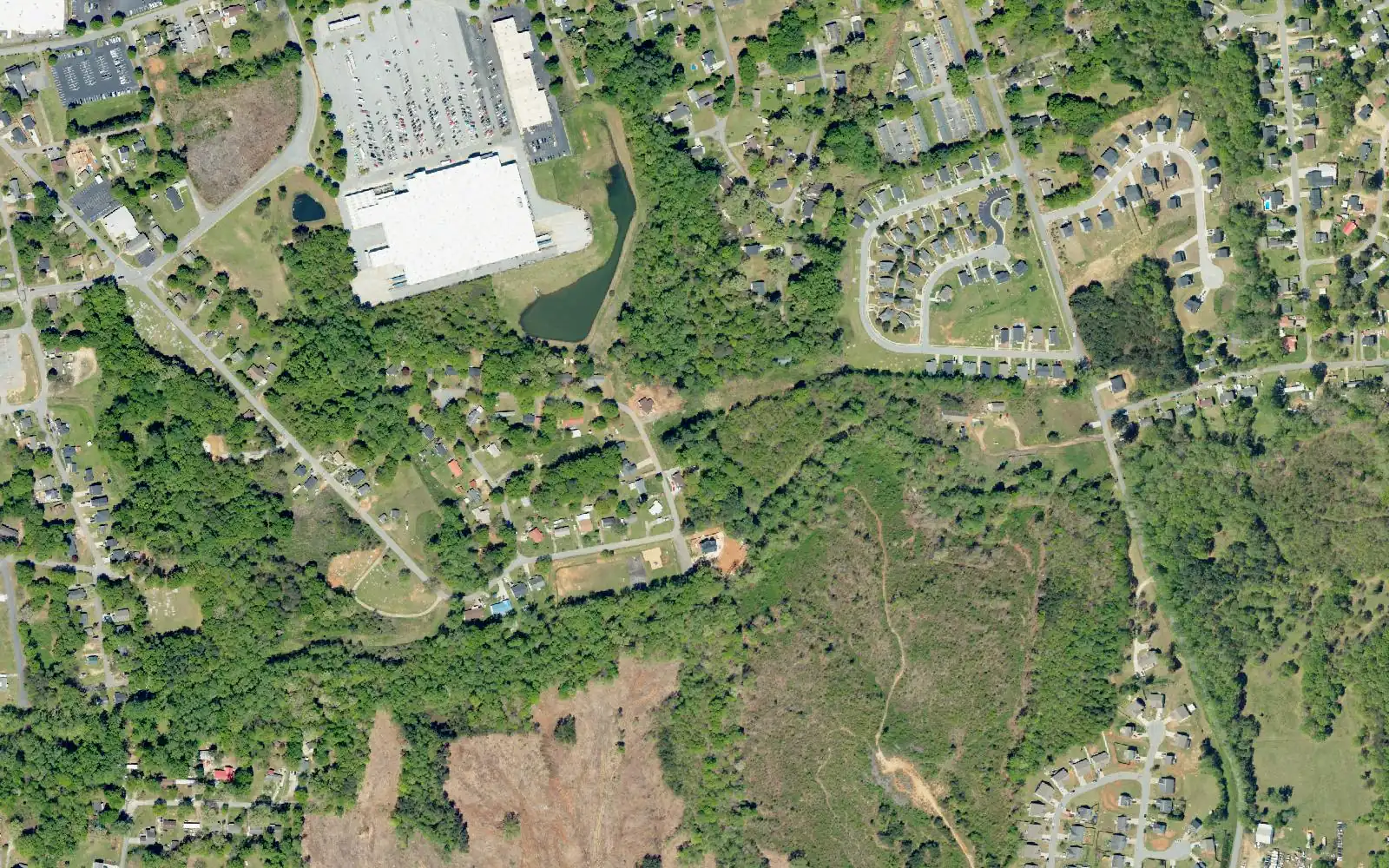
Sunnyside, northeast of downtown Greer in Spartanburg County, is mostly zoned for Crestview Elementary and Greer High; its east edge is in District 5.
Last checked Oct. 16, 2026. Sources: OpenStreetMap, the City of Greer’s GIS map service (city limits, county line, address points and major thoroughfares), its parks page and 2025 comprehensive plan update (PDF), Greenville County Schools’ Find Your School, Spartanburg District 5’s attendance lines map, the state’s 2025 school report cards and Zillow Research.
Sunnyside is the neighborhood northeast of downtown Greer, on the Spartanburg County side of Line Street. OpenStreetMap marks it near Sunnyside Drive, and the city’s plan names it as the “Sunnyside Neighborhood” that its planned Wards Creek Trail will connect to downtown.
What this means for you
- Zoned high school: Greer High for most addresses, with Crestview Elementary; the middle school is Greer Middle or Riverside Middle depending on the street. Byrnes High on the east edge. Check an address in Find Your School.
- Home value: $336,521 in ZIP 29651 in September 2026, according to the Zillow Home Value Index.
- Nearest interstate exit: I-85 Exit 58, Brockman McClimon Road, about 5.4 miles by road.
Part of our Greer neighborhoods guide.
Where it is
The city does not draw neighborhood boundaries. On this page Sunnyside means the residential addresses inside Greer’s city limits east of Main Street and north of Poinsett Street (SC 290), up to Wade Hampton Boulevard (US 29), plus the city’s homes just north of the boulevard east of Arlington Road. The city’s address file has about 1,620 residential addresses there, almost all in Spartanburg County.
Most are single-family homes. The older streets near downtown include Sunnyside Drive, Austin Street, Fairview Avenue, Arlington Avenue, Morgan Street, King Street and Highland Avenue; farther east are Biblebrook Drive, Ruddy Creek Circle and, past the boulevard, Lemon Creek Drive and Heartsong Court. Most addresses use ZIP code 29651; about 190 on the far east side use 29365.
The city’s comprehensive plan update says the Biblebrook bridge was closed for safety in 2020, cutting a link in the road network, and that the city is looking for federal and state money to replace it.
Schools
We checked 46 residential addresses across Sunnyside in Greenville County Schools’ Find Your School tool on Oct. 16, 2026, and matched every residential address to Spartanburg District 5’s attendance lines map. About 400 addresses, roughly a quarter, on the far east edge, including Lemon Creek Drive, Heartsong Court, Flint Lane and Coldbrook Drive, fall inside District 5. The rest are in Greenville County Schools; Find Your School matched 37 of the addresses we checked there. Ratings are the overall ratings on the 2025 state report cards (the 2024-25 school year), on a scale of Excellent, Good, Average, Below Average and Unsatisfactory.
| Level | Greenville County Schools | Addresses matched | 2025 rating |
|---|---|---|---|
| High | Greer High, 3000 E. Gap Creek Road | 37 of 37 | Good |
| Middle | Greer Middle, 3032 E. Gap Creek Road | 22 of 37 | Good |
| Middle | Riverside Middle, 615 Hammett Bridge Road | 15 of 37 | Good |
| Elementary | Crestview Elementary, 509 American Legion Road | 35 of 37 | Good |
| Elementary | Chandler Creek Elementary, 301 Chandler Road | 2 of 37 | Average |
Riverside Middle addresses were the streets closest to Poinsett Street, such as Austin Street, Arlington Avenue, Highland Avenue and Prince Street; Greer Middle addresses were farther north and east, such as Biblebrook Drive, Lorla Street, King Street and Morgan Street.
The District 5 addresses are zoned for Tyger River Elementary (Excellent), Beech Springs Middle (Average) and James F. Byrnes High (Good). More in our schools guide.
Home values
The typical home value in ZIP 29651 was $336,521 in September 2026, up 1.57% from $331,307 in September 2025, according to the Zillow Home Value Index. In ZIP 29365, which Zillow lists under Lyman, it was $305,747, up 1.54%. The index is a modeled typical value for the middle third of homes, not a sale price, and both ZIP codes cover far more than Sunnyside. The citywide figure was $349,020. More in our home prices guide.
Parks and trails
From the city’s parks page:
- B.P. Edwards Park, 265 Oak St.: playground, full basketball court and covered picnic shelter on 4.2 acres.
- Greentown Park, 224 E. Bearden St.: playground, swings, basketball court, walking path and shelter on 3 acres.
- Wards Creek Park, 110 Greenleaf Drive: playground, swings, basketball court and recreation field on 5 acres.
- Wards Creek Trail: the city’s plan describes a 12-foot-wide paved trail for walkers and bicyclists from Sunnyside to downtown, funded in part by the Greenville-Pickens Area Transportation Study and the South Carolina Ports Authority. Phase 1 is a proposed 0.45 mile from Biblebrook Road to Wards Creek Park.
Greer City Park and City Hall are just southwest, downtown. More in our parks guide.
Getting around
- Interstate: I-85 Exit 58, Brockman McClimon Road, about 5.4 miles by road from the middle of the area; Exit 60, SC 101, about 5.9 miles. Exit numbers are from OpenStreetMap.
- Downtown Greer: about 1.2 miles by road to City Hall, 301 E. Poinsett St.
- Airport: about 8.1 miles by road to the terminal at Greenville-Spartanburg International Airport. Both are distances measured on the OpenStreetMap road network with the OSRM routing engine, not drive times.
More in our getting around guide.
Groceries and everyday stores
From OpenStreetMap: Walmart Supercenter, 14055 E. Wade Hampton Blvd., with a pharmacy, inside the area, and Quality Foods, 510 N. Main St., at its west edge.
How we drew this area
The Sunnyside name comes from OpenStreetMap’s place marker and the city’s plan. The edges follow Main Street, Poinsett Street, Wade Hampton Boulevard and the city limits. School zones come from 37 addresses matched in Find Your School and from every residential address point matched to District 5’s map. Store locations are © OpenStreetMap contributors.
Frequently asked questions
What schools serve Sunnyside in Greer?
Most of Sunnyside is in Greenville County Schools. Of 37 addresses we matched, all were zoned for Greer High (rated Good on the 2025 state report card), 35 for Crestview Elementary (Good), and the middle school split between Greer Middle (22) and Riverside Middle (15). About a quarter of addresses, on the east edge, are in Spartanburg District 5 and zoned for Byrnes High.
What is the Wards Creek Trail in Greer?
A planned 12-foot-wide paved trail for walkers and bicyclists that will connect the Sunnyside neighborhood to downtown Greer, according to the city. Phase 1 is a proposed 0.45-mile trail from Biblebrook Road to Wards Creek Park.
Is Sunnyside in Greer a good place to live?
Here are the facts. Sunnyside is a mostly single-family area about 1.2 miles by road from City Hall, with three city parks. Most homes are zoned for Greer High, rated Good for 2025, and the typical home value in ZIP 29651 was $336,521 in September 2026, according to Zillow.
Have your say